- Home
- Contents
- Maps
- Concerning Place Names
- Introduction
- Chapter 1: The Lay of the Land
- Chapter 2: The People of the Sound
- Chapter 3: The King George Men
- Chapter 4: The Boston Men
- Chapter 5: “Outrages and Disorders”
- Chapter 6: Enter the Missionaries
- Chapter 7: The Sealing Years
- Chapter 8: Setting up Shop
- Chapter 9: “Alive with Fish”
- Chapter 10: “Teeming with Riches”
- Chapter 11: The Hopeful Coast
- Chapter 12: Disconnection
- Chapter 13: Separation
- Chapter 14: Community
- Chapter 15: The Japanese
- Chapter 16: Boat Days
- Chapter 17: Wartime
- Chapter 18: Peacetime
- Chapter 19: Lovely Road
- Chapter 20: Adjustment
- Chapter 21: The War in the Woods
- Chapter 22: The Emerging Scene
- Timeline
- Acknowledgements
- Selected Sources
- About the Authors
![]()
![]()
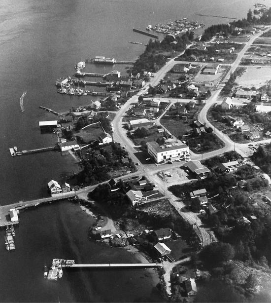
Chapter 19: Lovely Road
On August 22, 1959, every roadworthy vehicle in Tofino and Ucluelet—all seventy-four of them—assembled to form an excited cavalcade and set off to make history. Carrying a total of 300 passengers, the cars gathered at the junction of the road leading to Alberni. Travelling in a convoy, they departed at 6 a.m. to inaugurate the new road, with each vehicle displaying a ticket—purchased for five dollars—for the privilege of participating. It had taken five years for the logging companies and the Department of Highways to patch the various sections of the road into a more or less navigable thoroughfare. Some work trucks had already gone along the road, but this cavalcade of local vehicles truly marked the opening of the road.
Each driver signed a waiver absolving the road builders of any liability for damage or injury and agreed to adhere to four rules: to stay in line; not to stop except at the four designated stopping points; not to throw matches or cigarettes from their cars, and not to smoke at the stopping points; and to drive as near as possible to the car in front. Some creeks still had no bridges, and the vehicles had to ford them, one by one, led by a pilot truck. Everyone made it through safely, arriving in Alberni three hours later, covered with dust, car horns sounding triumphantly. Many continued to Nanaimo, where they posed for a photograph in Beban Park, and some did not want to stop, carrying on to Victoria. “The experience of driving over paved roads with traffic lines…was new for most of these people,” commented George Nicholson in the Colonist. He drove in the lead car with Tom Gibson, president of the Tofino Chamber of Commerce. The oldest person making the trek out, Anton Hansen, aged eighty-five, had waited for this road for fifty-five years; next in age, Fritz Bonetti, seventy-five, had lived at Long Beach since 1912.
Not long after, on Labour Day, forty cars travelled westward from Sproat Lake to Long Beach. By the end of that weekend, an estimated 3,000 people and some 700 cars had travelled over the road in one direction or the other, according to George Nicholson. Many unwary drivers hit the sands of Long Beach, delightedly revving their engines and racing across the open stretches with absolutely no understanding of what could happen or what areas to avoid. That weekend, local resident Paul Norton pulled fifty-four cars off the beach with his jeep, saving them from sinking into areas of soft sand. He charged ten dollars per car. A new local business had been born.
When Rowland Brinckman wrote his poem in the 1930s, expressing hope for a “lovely road,” he may not have had quite this road in mind. Most people who drove over it more than once soon had a section or sections they feared, dreaded, or hated: the switchbacks, the washouts, the dizzying heights, the drop-offs, the spectacular slippages, the stretches that seemed to zigzag crazily for no good reason. Alex Masso of Opitsaht believed he knew the explanation for one particularly scary and winding section of the road; it was obvious, he said. The surveyor was on a drunk at the time.
Following the much-publicized opening, the road, officially named Highway 4, remained closed to the public during daytime hours, with locked gates at both ends, to allow the loggers to get on with their work. The gates stayed in place until 1964. For years after the opening, the road remained extremely challenging for drivers, and the journey fraught with peril. Noel Hamlin of Alberni inaugurated a bus service, valiantly navigating his thirty-three-seat vehicle over the new road three times a week. In December 1960, with eleven people on board, he had to drive through a massive washout in the dark, with water up to his headlights, pushing floating logs out of his way. “Water gurgled under the bus door” a local newspaper reported. A year later, Hamlin made the news by commandeering a Department of Highways grader one night, and grading a particularly bad five-kilometre stretch. Accused of stealing and damaging the grader, he faced a hefty bill from the department, and a fine. “I’m damned if I’ll cough up,” he told a reporter. “I’d rather go to jail than pay a cent.”
Driving Highway 4 was not for the faint of heart: extremely narrow in places and devoid of barriers along its edges, its steep switchbacks, climbing to 580 metres above Sproat Lake and back down to lake level, reduced some drivers to tears. “Many of the people who had come to Tofino by road refused to return over it, opting either to fly out or go by boat,” commented Dr. Howard McDiarmid. He recalled the time he and his family drove his powder blue Chevrolet Bel Aire over the road in the early 1960s, suffering not one, but two, flat tires. They spent the night in the car waiting for a truck to come along the next morning. The truck took McDiarmid and the tire rims to town to be re-shod while the family awaited his return.
The doctor saw the impact of the road on his patients. “I had more than a few requests for tranquilizers from people who were heading out on the road...Most locals who had to use the road carried two spare tires, extra oil, food and, in winter, sleeping bags. Everyone had their favourite horror story...mine involved a night during the winter when it was snowing heavily. We had chains, so we made it up the west end of the switchbacks fairly easily, but going downhill on the east end, even with chains, was like going down a ski jump with curves.” The district highways manager sent out a sanding truck in response to McDiarmid’s call, “but it was so slippery the truck flipped over. They closed the road.” As journalist Jack Scott dryly commented, the road was “not yet suitable for a gay party in an open convertible.”
Despite all these difficulties, the new highway brought immediate changes. Fish and freight companies began shipping their goods to market over the road. This change in transport saw several ice plants pop up along the Tofino and Ucluelet waterfronts, allowing fish caught at daybreak to be iced down and trucked out to Victoria and Vancouver within twelve hours. This meant more fish could be caught and shipped, so ever more fish boats began working on the outer coast. At one stage in 1964 during a particularly good salmon run, over 400 fish boats tied up in Tofino. At night, the lights of seemingly countless boats could be seen lined up at anchor on the inside of Wickaninnish Island, waiting to go out at dawn. Bob Wingen, now the third generation of Wingens working in Tofino, became the first in Tofino to acquire a fish-packing vessel, the Harriet E. This boat would load up with ice and head out to buy fish from camps up the coast as far as Winter Harbour, returning to Tofino to be met by trucks ready to load the iced fish and drive out of town. This system continued into the 1970s, fading out when larger fish boats carrying their own ice came on stream, making the large fish packers redundant.
For a few years in the early 1970s, Bob Wingen attempted to speed up fish transport by adding the element of air travel. He acquired two Norseman seaplanes for his Sea-Air-Pac Company, employing local pilots Doug Banks and Gary Richards to collect fish from the fish camps along the coast, then return to Tofino to load the fish onto trucks for transport to Vancouver or Victoria. Wingen’s long-term dream was to fly fish into Tofino from isolated fish camps, and fly it out again from the airport in big cargo planes. This never happened; even the short-haul flights of Sea-Air-Pac did not last long, running into too many technical problems.
The 1960s boom in salmon fishing could not be sustained. Salmon runs, by their nature, fluctuate from year to year, and the 1965 sockeye run proved a huge disappointment, even as improvements in fishing equipment and larger boats allowed greater catches. In an attempt to rectify these imbalances and to maintain sustainable yields without impairing the survival of the salmon stock, in the late 1960s and early 1970s the Department of Fisheries implemented a number of measures. It limited the number of fishing licences, it regulated the size of the harvest, and it introduced a salmon enhancement program by building new hatcheries. The limitations in the salmon fishery led some Tofino fishermen to branch out and harvest halibut, shrimp, crab, and anchovies. For a while the Japanese market demanded sea urchins, harvested by divers, packed on ice in small wooden boxes, and shipped to Japan by air. Divers also harvested abalone, a practice banned by the mid-1970s, as well as geoducks and sea cucumbers.
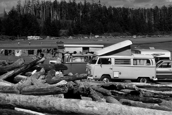
Once the locked gates on the road to Alberni disappeared and daytime restrictions ended in 1964, visitors began travelling out to the west coast in ever greater numbers to camp and party on Long Beach. More and more vehicles appeared on the beaches, with some people overnighting in campers and vans, and others in tents amid the driftwood above high-tide level. Often tents pitched by the unwary flooded when the tide rose. In short order, residents living on or near the beach, including Peg Whittington and the Lovekins, “found themselves dealing with uninvited visitors knocking at the door looking for water, a toilet, a phone, or help to rescue a vehicle stuck in the sand,” according to Adrienne Mason in Long Beach Wild. The Lovekins ended up erecting a barbed-wire fence along the front of their property to keep people away.
Among the many who wanted to see just how fast they could drive their cars along the beach was Vancouver Sun columnist Allan Fotheringham. On June 30, 1961, he wrote: “I drove the length of the beach, most of it at 70 mph [112 kilometres per hour]…When the tide is out and the hard-packed sand stretches a half-mile, you can hit 100 [160 kilometres per hour].” Navigating around the World War II pilings, which still studded the beaches since being installed to prevent enemy craft landing, made the wild drive even more exciting. These pilings remained on Long Beach and Chesterman Beach, and in Cox Bay, long after the war, although many disappeared with the action of surf and tide. Eventually Tom Gibson and his sons accepted a contract to blast the remaining ones away at five dollars apiece. They missed a few, and to this day traces of these wartime defences still emerge at the lowest tides.
The notion of driving on Long Beach had seemed such a grand idea in earlier years, when newspaper articles anticipated the thrill of driving along the beach, several cars abreast. But now, “residents watched, both amused and appalled as tourists tore up and down the beach and through the surf,” wrote Adrienne Mason, “often becoming swamped at the mouth of Sandhill Creek or mired in the wet sand. Many cars were so hopelessly stuck...that the owners just left them. To this day, every once in a while, especially in winter when storms and high tides have scoured the beach, a corroded chassis emerges from the sand.” Jim Hudnall counted himself lucky; unlike many, his vehicle survived its submersion in sea and sand. “We had the VW van on the beach and it began to sink in the soft sand as the tide came in, so we took out the battery, plugged the carburetor with rags and removed everything. The tide covered it and we waited until low tide the next morning, got it towed to higher dry land, hosed it off in fresh water from a nearby stream, and lo and behold, it started right away, and we drove it back to Seattle.”
“I towed over 200 cars off the beach,” Neil Buckle recalled of his years living at Combers’ Beach. “One time, these guys had soaked the ignition and…they finally came up and said they needed a pull to get started…I pulled and pulled them with my old Ford car and in the end we did get it going. They asked what they owed me and I said ‘Oh this will be twenty dollars,’ or something like that. ‘Well, we don’t have any money but we have a set of Snap-On Tools. Can we leave them with you until we come back and pay you tomorrow?’…I was really hoping that he wouldn’t come back and pay me, but he did, unfortunately.” According to Buckle, “People drove on Chesterman’s Beach, too, but it was pretty hard to get stuck on Chesterman’s because it was so hard-packed. The old chassis at Chesterman’s that appears in the sand now and then is from a ‘car-be-que.’” So-called car-be-ques occurred when revellers decided to set fire to old cars.
Unquestionably, all the newcomers and visitors to the beach had an immediate influence on the economy of the area and the services offered. From 1965 onward, Abbott’s Store, located just behind Long Beach, also housed the Long Beach post office, with Archibald Henry Abbott as postmaster. This was the first post office at Long Beach since Hazel Donahue briefly acted as Long Beach postmistress from her home at Camp Maquinna in 1946–47. Abbott’s also operated a gas station. Another, the Long Beach Service Station, opened in 1958 just south of Green Point, with Surfway Market opening across the road. The Kimola Motel stood near the road now leading to the golf course, and in 1962 the provincial campground opened at Green Point, offering eighty-nine campsites for visitors. The Long Beach School near Schooner Cove welcomed over eighty students during the early 1960s; numbers later fell to around forty before the school closed in 1970.
With the road open, and with a growing number of visitors looking for places to stay, Robin Fells and Jeff Crawford sensed an opportunity. The Vancouver businessmen partnered with Joe Webb, who owned the Wickaninnish Lodge, and together they secured financing and began building the impressive new twenty-two-room Wickaninnish Inn, on the site of Webb’s lodge. The hotel stood on a rocky outcrop, offering stunning views of the beach and the ocean. People flocked here from far and wide to sit in front of the fire, enjoying the relaxed atmosphere and upscale service, including world-class cuisine. A 1964 newspaper article, appearing just after the new inn opened in July of that year, described the Wickaninnish Inn as “an improbable first-class hotel.” Few expected to find such top-notch accommodation in such a remote location, particularly in a hotel that took pride in offering no radio, television, newspapers, or telephone. Many guests flew in to Tofino Airport rather than face the not-so-lovely road from Alberni.
Beachfront accommodation in the area also included the MacKenzie Beach campsite, nearer to Tofino. The MacKenzie family had owned property there since Donald MacKenzie, a veteran of Vimy Ridge, came to work as the Lennard Island lightkeeper in the mid-1920s. In 1929, for $250, he purchased 400 metres of shoreline on sixteen hectares of land at the beach now bearing his name, previously known as Garrard Beach. Francis Garrard had pre-empted two large tracts of land there in 1906 while working as Lennard Island’s first lightkeeper. Because Lennard Island had an unreliable water supply, the Garrards often came over to the beach to do laundry, washing their clothes in the stream. In the 1930s, Donald MacKenzie and his wife Mina built a home on the beach from lumber milled by the Darvilles at Calm Creek and towed around to their site. They had nine children in all, the four younger boys born in Tofino. Bob MacKenzie recalled walking into school in Tofino at the age of seven, four reluctant kilometres there and back each day, along the rough trail to and from what Rowland Brinckman dubbed “MacKenzieville.”
By the late 1950s the MacKenzies had sold their sixteen-hectare beach property and moved away, but the family maintained a foothold on the beach. In 1956, Bob MacKenzie purchased a parcel of land adjacent to his family’s original property, and in 1965 he and his wife Doris moved from Tofino to their MacKenzie Beach home and opened a campsite and mobile home park there. By 1968 they offered thirty campsites and started developing plans to offer further accommodation.
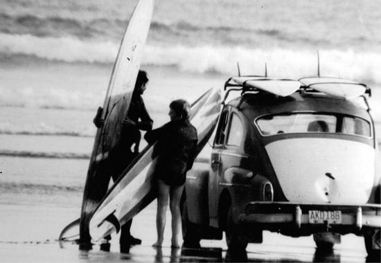
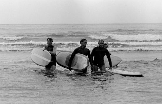
The new road provided ready access to the swells of Long Beach and the other beaches for a small number of surfing enthusiasts who had already begun surfing farther down the coast at Pachena Bay and Jordan River. This band of surfing pioneers launched an industry that has become one of the main economic engines of the Tofino area. Though surfing as a board sport originated in Hawaii, the Nuu-chah-nulth people had long practised surfing their canoes onto beaches. In 1912, John Ross, principal of the Ahousaht residential school, mentioned in a report to the Department of Indian Affairs that “canoe racing and surf riding are common amusement during the summer months.” Two years later, Mr. H.N. Clague, in his report to the Department of Lands, wrote of the beaches on the west side of Vargas Island: “No more enjoyable sport can be imagined than surf-riding at any one of these delightful stretches of clean sand.” Bruce Lucas grew up canoe surfing at the surf break at Hesquiaht Point, always trying for bigger and bigger waves. Despite his mother’s anxiety, he and his friends loved braving the big seas in their small canoes, “paddling as fast as we could [to] catch the wave when it started breaking.”
“Boarding,” as some early settlers called it, appears to have been practised in the 1920s. In the Colonist of December 1, 1929, Gertrude Jackson mentioned the attraction of surfing: “Long Beach…could become a most popular Summer resort with golf, horseback riding, motor racing, as well as hunting, hiking, boating and surfboard riding, the latter providing a thrill that is hard to excel.” Two years later, in an article dated March 19, 1931, the Colonist commented: “The first bathers of the season plunged into the Long Beach breakers. There was quite a ground swell caused from the last gale, thus making it very interesting riding the surfboard.”
The modern surfing era began in the mid-1960s with Jim Sadler, Ralph DeVries, and Bruce Atkey, among others, setting the pace. They braved the six degree Celsius water, wearing wetsuits and using homemade surfboards. “The thick, heavy, diving suits weren’t very supple and to add warmth they coated themselves with Vaseline to ward off the cold,” Ruth, Sadler’s wife, remembered. They ordered surfboards from California, and as Ruth recalled, “They held their breath hoping [the boards] would arrive in one piece.” Later, as demand grew, Atkey drove to California from time to time, buying surfboards for under fifty dollars, loading them into his VW van, and bringing them back to Vancouver Island for resale.
Ralph DeVries, who worked as a carpenter building the Wickaninnish Inn in 1963–64, stayed on as a cook and learned the rudiments of surfing from some Californians visiting Long Beach. He went to Victoria and purchased a surfboard from a pawnshop. When the inn’s manager, Robin Fells, saw DeVries enjoying himself so much on his board, Fells purchased a few boards so that he and his guests could also try surfing. Instead his staff co-opted most of the boards. “We had a hell of a lot of fun,” remembered DeVries. “I’d cook in the morning and surf in the afternoon.”
By then Jim Sadler and his family, who had been surfing at Pachena Bay, had arrived in Tofino. Having come temporarily to help local businessman Jack Walters build his grocery store in the town, Sadler fell in love with Tofino and the surfing and stayed, becoming a leader in the Tofino Bible Fellowship as well as a legendary surfer. Often these surfing pioneers had the “long beaches”—Wreck Bay, Long Beach, Chesterman Beach, Cox Bay—entirely to themselves.
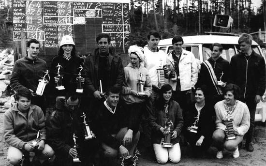
By 1966, enough enthusiasts surfed on the west coast to inspire the Jordan River surf club to sponsor Canada’s first surfing competition, the Long Beach International Surf Contest, at Wickaninnish Beach on the May 24 weekend. The two-day event drew forty contestants, each paying an entry fee, and some 2,000 spectators. With contestants from the Americas, New Zealand, Vancouver Island, and the Lower Mainland, as well as local surfers, the event proved a huge success. New Zealander Paul Griffin won the men’s division, with local Jim Sadler, riding his own homemade board, placing second. New Zealander Ginty Bigwood came third, with local Paul DeVries fourth. Victoria’s Joan Oliver won the women’s trophy with Lynn Bissel, also from Victoria, placing second. Terry Ismay won the junior men’s award. This event received mainstream—if incredulous—publicity. “Surfing in Canada? Aw, go on!” declared an article in the Vancouver Sun on June 10, 1966, following with an admiring description of the success of this first ever event.
The surfing competition continued for another two years, but by 1968 so many rowdies turned up to party rather than watch the surfing that the organizers cancelled further events. The termination clearly showed how the uncontrolled party atmosphere at Long Beach on summer weekends was beginning to wreak havoc. On holiday weekends, thousands of people—up to 7,000 at a time—descended on Long Beach to camp. Cars careened around on the beach, towing riders balanced on drift logs or old car hoods; this “sand sledding” developed into “pallet surfing,” with riders perched on wooden pallets tied to back bumpers of cars. In 1966 an eighteen-year-old from Vancouver died when struck by a car on Long Beach. Visitors raided the beach, digging indiscriminate quantities of razor clams—some collecting hundreds of kilos at a time—and hauling them off the beach in garbage cans. People also collected large numbers of sea stars as souvenirs, all too often leaving the creatures to rot in plastic bags. Heaps of garbage remained on the beach after the crowds departed, and with no public toilet facilities, as Peg Whittington bluntly stated, “the beach stunk.”
In his essay “The Beaches of Clayoquot,” Brian Brett described the scene: “Windsurfers on wheels whistled down the beach, and cars dodged families and children and hippies...The police were chasing a drug dealer and they...sank into a sand pool. The car could have been rescued. No-one helped them, they were too busy cheering as the tide came in, pounding the car out of sight. There was dog shit everywhere. Garbage and plastic bags and tarps littered the driftwood line, and toilet paper hung in the trees. Endless parties. Stoned-out hippies. It was a carnival on sand.”
By the late 1960s, a different scene appeared south of Long Beach at Wreck (Florencia) Bay, where members of the “Tune in, Turn on, and Drop out” generation chose to make their stay more permanent. They turned that beach into a mecca for the counterculture of the time. Hippies, dropouts, and flower children, Vietnam draft dodgers, Vietnam vets, and other itinerant young people began trickling onto Wreck Bay in 1968–69, selecting it for its isolation, away from the more mainstream visitors on Long Beach. They erected semi-permanent dwellings high on the beach, where they “[lived] off youth and a dream in plastic and driftwood shacks,” as Adrienne Mason wrote in Long Beach Wild. Ridding themselves of inhibitions, many went naked, smoked marijuana, dropped acid, and lived a laidback lifestyle as far away as possible from the restrictions of a society they felt had gone badly awry. Many of the beach dwellers drifted back to urban settings during the winter, but a few chose to remain at the beach year-round. The loosely knit community also attracted those who dropped by for a few days or weeks, just to see what was going on. One summer the young Margaret Sinclair spent time there; a few years later she married Prime Minister Pierre Trudeau. Their son, Justin Trudeau, is now Canada’s Prime Minister.
Not all of the beach dwellers lived right at Wreck Bay; some lived on the outer islands, a number in shelters at Schooner Cove, and in the winter months some stayed at cabins at Peg Whittington’s place on Long Beach. Members of this group valued Peg’s encouragement of their artistic pursuits. A few went on to become well known in the Canadian art scene, including the musician Valdy; writers Susan Musgrave, George Ryga, and Sean Virgo; and actress Frances Hyland, as well as environmentalist Vicky Husband.
At Wreck Bay, the flock of newcomers dispersed all along the five-kilometre beach, some even along the cliffs, in their shelters and tents. According to Adrienne Mason, “They played drums and flutes, carved sculptures from driftwood, cast candles of the Wreck Bay cliffs. A joint, a jug of cheap wine, or a tab of acid was rarely far out of reach.” At the height of their tenure, as many as 500 people occupied the Wreck Bay beach during the summer months. Among them, Bruce Atkey, who split cedar shakes from driftwood and sold them or used them to build various structures along the beach. “We were hippie shakers,” Atkey remarked. He continued living around Tofino for years, well known for building beautiful and inventive structures from beach wood and split cedar. Many others at Wreck Bay produced highly creative arts and crafts, some of which sold through local shops. Acclaimed sculptor and wood carver Godfrey Stephens became a familiar presence on the beach during those halcyon days, working on his carvings and revelling in what he termed the “panorama of Florencia…raining in light.” On July 20, 1969, he joined the “wild people listening to short wave radio at the exit of Lost Shoe Creek, full moon above. Listening to…one step for mankind,” as astronaut Neil Armstrong descended from Apollo 11 to walk on the moon.
In 1971, Ucluelet resident Pat Hutchinson worked as an enumerator for the Canadian census, a task that included counting heads at Wreck Bay. “I interviewed as many as I could,” she wrote. “To try to count them with their daily comings and goings was a quite impossible chore. Many were non-Canadians, some refused to be interviewed, some refused to give surnames or addresses, others said they were just passing through. For some three miles [five kilometres] one could see a continuous stretch of great piles of logs…arranged and re-arranged to make so many styles of dwellings that one could only say that they were indescribable...along the top of the cliffs, for at least two miles, in every nook and cranny and in every small clearing other, more comfortable shelters had been erected.” Along the beach she saw “great imagination coupled with ingenuity to utilize driftwood boards and beachcombed chains and old pieces of iron gratings…to improvise dwellings that were comfortable and extremely picturesque. There were kettles strung from chains, old pots strung from log frames, stone fire boxes, benches, tabletops, and hollowed out holes in the sand for sheltered sleeping quarters. Although a few had paid slight heed to such niceties, most had also set privy holes well back from the main beach.”
For the most part local residents tolerated the offbeat newcomers, picking up the hitchhikers and sometimes helping them sell their arts and crafts. Their way of living may have shocked some, but it fascinated almost everyone, and few could resist going to have a look. One summer day, Charles McDiarmid, aged about twelve, went to visit Wreck Bay with his mother, who maintained this was a sight not to miss: “I remember the beach being absolutely packed, with lots of little shelters along the shore in the driftwood, and half the people were naked.” A young man wearing ragged, multicoloured bellbottoms walked toward them. Naked to the waist, deeply tanned, and completely oblivious to others, he played his silver flute, seemingly in a trance. With his flute flashing in the sun, the music faded as he passed; for Charles McDiarmid, this seemed the essence of Wreck Bay.
Some local residents complained that the hippies discouraged public use of the various beaches by their appearance and behaviour. “They are not helping us to attract legitimate tourists,” declared Mike McGeein, chairman of the Ucluelet Chamber of Commerce, in a Vancouver Sun article. “We have discussed ways to get rid of these undesirables, but there is nothing we can do. We have checked with everyone and they are free to come and go as they please.” Certain locals even talked of forming vigilante committees to take unilateral action against people with long hair and beards who, they felt, having taken over various areas such as Wreck Bay and Schooner Cove, regarded these beaches as their own. “Some of the working people of Tofino resented the idleness of the hippies,” commented Ruth Sadler.
A significant number of the young people who landed in the Tofino area in the late 1960s and the 1970s relied on welfare cheques to get by. The welfare office in Port Alberni sent an official to Tofino once a week to distribute cheques from the municipal offices. Jacqui Hansen, then the town clerk, recalled: “I remember the smell when they came into the office to get their cheques—it was that oil they all wore, patchouli oil. The place just reeked after they left, we always had to air it out.” Jim Hudnall felt differently about that odour. He enjoyed picking up hitchhikers in his VW van and the “combined smell of wood smoke and human scent, and the lovely patchouli oil smell.”
Jim Hudnall and his wife, Carolyn, made their first trip out to the coast in August 1967. “When we got to Port Alberni there was a bad forest fire burning and the road was closed during the day for firefighting but they allowed cars through at night,” Jim said. “So we drove into unknown territory with the fire burning on both sides of the road and all around Sproat Lake, and we arrived at Green Point campground in the dark. We woke up next day and saw the view for the first time. I thought I’d died and gone to heaven.” That first summer they stayed on Frank Island off Chesterman Beach, parking their VW van on the island above the high tide mark. In subsequent summers they camped at various locations before finding a cabin at Schooner Cove, built by Bruce Atkey. “The Whole Earth Catalog was our Bible. It was full of ideas about how to build, about septic and water supply systems etc. We were pretty isolated and cut off so we had to fend for ourselves.”
Whatever isolation newcomers and beach dwellers on the coast may have experienced, it could not compare to that of earlier years. After the rough, narrow ribbon of a road punched its way over the mountains to the coast in 1959, the isolation of Tofino and Ucluelet effectively ended as commercial and recreational traffic grew, and as outside influences arrived, affecting everyone in the area. The Tla-o-qui-aht people bore the impact of this change more than the other First Nations of Clayoquot Sound because large areas of their traditional territory became accessible by road for the first time in history; their traditional village of Esowista lay directly alongside the road. Only a handful of people lived there permanently before the 1960s, but in subsequent years the village expanded considerably in size; its population now exceeds that of Opitsaht, the principal Tla-o-qui-aht village. Yet even Opitsaht, across the water from Tofino, soon felt the effects of the road, as goods and services became more easily available. In 1964, Opitsaht became electrified when BC Hydro laid 2,500 metres of submarine cable across the harbour from Tofino. All homes in the village quickly wired up, and local merchants did a brisk trade as Opitsaht residents rushed to buy televisions, fridges, washers, and dryers.
Because of its more remote location, the Ahousaht village of Maaqtusiis did not experience such abrupt changes. By the 1960s it had fallen on hard times, out of sight and all too often out of mind of government authorities. “Man comes in a boat, usually every month,” commented Mark Atleo, a band councillor at the time, describing the Indian agent’s visits. “All the time he’s got one foot on the dock and the other foot on the boat.” Following a visit in April 1965, journalist Terry Hammond wrote a damning article in the Daily Colonist. “Ahousaht village is a collection of weathered, grey, rot-infested shacks…inhabited by 400 human beings. Of these a dozen have jobs, the rest exist on the scanty pickings of welfare and unemployment insurance.” The fleet of fish boats at Ahousaht had numbered fifty in the mid-1950s; now only about twenty did any fishing. Hammond described the village as a living ghost town, the homes ravaged with decay, broken windows boarded up or stuffed with rags, and up to sixteen people crammed into each tiny fire-trap home. One family with eleven children lived off $136 per month. A four-room schoolhouse had some eighty children enrolled, but “many parents prefer to send their youngsters to a residential school in Port Alberni where, they claim, a better education is offered.” The two churches, Roman Catholic and United, stood in stark contrast to the rest of the village, with their “sparkling paint and solid construction.”
Hammond interviewed Paul Sam, the first elected chief councillor of the Ahousahts, and also the “hereditary speaker for the hereditary Ahousaht chiefs.” Sam spoke of the losses his people had experienced: “This was a fishing village, but the salmon are going because the white man has not cared for the spawning beds and the cod have been over-fished by the trawlers. The clams have died from the waste of the herring reduction plants. The sea otter is gone and we can no longer shoot the seal. Now we can’t even cut down a tree to make a dugout…Now Ahousahts can’t live like Indians, but white man has no jobs for us. Maybe by and by there be no Ahousaht village.”
Shawn Atleo (A-in-chut), former chief of the Assembly of First Nations, and a hereditary Ahousaht chief, remembered hearing as a child about Ahousaht’s grim prospects. “When I was five or six, we were living in Bella Bella in the Central West Coast,” he told a reporter for the Vancouver Island University News. “There was a superintendent at that time who was advising a teacher who was considering going to Ahousaht. He said, ‘Don’t bother going to Ahousaht’—in essence he was saying it’s a dying community. Nobody will be there in 20 years.” Shawn Atleo’s father, E. Richard Atleo, responded to this by taking his family to Maaqtusiis where he became school principal in the early 1970s, helping revitalize the community.
In 1973 Ahousaht had a brief brush with fame when chosen as the location for the movie I Heard the Owl Call My Name. Featuring actor Tom Courtenay in the leading role, as well as Alberni’s George Clutesi and Ahousaht’s Margaret Atleo, the filming took several weeks in September of that year, with local residents and others enjoying walk-on roles. The cast and crew filled every available room in the Tofino area during the shoot, and the movie premiered at the Tofino Legion, to hoots of recognition as familiar faces appeared onscreen.
The idea of creating a national park around Long Beach dates back to 1929, when the Canadian National Parks Association first put the idea forward. Following a visit to the coast with two government surveyors in 1931, J.M. Wardle, chief engineer of the federal Parks Department, praised the beauty of the area but did not support the idea of establishing a park here, seeing far too many drawbacks, including the cold water temperature and the fog. Despite strong local support for a park, the initiative faded into the background for many years. The provincial government acted first, setting aside land at Green Point in 1948, which later became Wickaninnish Provincial Park. Lobbying continued for a national park at Long Beach, backed by Tofino’s mayor Tom Gibson and other local businessmen, but no real action occurred until after the completion of Highway 4. Through the 1960s, the mounting summertime chaos on the beach could not be ignored; as Adrienne Mason wrote, “the need to protect the land from the public [gained] serious attention.”
By 1966, discussions had advanced to the point that the provincial government offered Wickaninnish Provincial Park as part of a larger national park. Dr. Howard McDiarmid took up the cause, championing the idea of a national park during his successful 1966 provincial election campaign. Like all other local people he saw conditions rapidly deteriorating on Long Beach year by year, and in February 1968 he gave a famous speech outlining the situation to the provincial legislature: “Are you aware, Mr. Speaker, that on July 1 of last year there were 7,000 campers tenting on Long Beach provincial park, crammed in cheek by jowl, defecating, micturating [urinating] and copulating—not separated by so much as a blade of grass, Mr. Speaker? In fact, barely a grain of sand. Motorcycles racing up and down the beach, airplanes landing and taking off, no water and two toilets for 7,000 people?” An irritated editorial in the Vancouver Sun on March 1, 1968, pointed out that west coast visitors were still putting up with “slum conditions” on their major beach, while politicians endlessly talked.
In 1968, Jean Chrétien became minister of Indian Affairs and Northern Development, the department responsible for national parks. Ken Kiernan, BC’s minister of recreation, invited Chrétien to tour the area by helicopter, followed by lunch at the Wickaninnish Inn. Impressed by what he saw, Chrétien agreed to work with the province to establish a park that would encompass not only Long Beach and an area extending over the peninsula to Grice Bay, but also the more than 100 islands and islets of the Broken Group in Barkley Sound, and the area from Cape Beale to Port Renfrew, including the seventy-five-kilometre West Coast Lifesaving Trail, giving a total park area of 511 square kilometres. In 1969 the two levels of government agreed to split the cost of acquiring land, and the BC government set in place a plan to create the park in three units, one by one: first Long Beach, then Barkley Sound, then the West Coast Trail section. The two levels of government finalized the deal in April 1970.
On June 16, 1970, in a much publicized visit, Prime Minister Pierre Trudeau helicoptered in to Long Beach to survey the area of the new park and to try his hand at surfing. Robin Fells of the Wickaninnish Inn provided Trudeau with a wetsuit and a surfboard, and along with two other surfers they braved the frigid water. The prime minister managed to stand on his board on his first attempt, and they enjoyed over half an hour in the waves. According to the Daily Colonist, Trudeau returned to shore with “legs pink as Tofino crabs from the slap of icy waves, yellow towel draped rakishly around his ears,” to greet a small crowd. During his visit, a bearded youth with long hair asked him “When are you going to legalize marijuana?” and Trudeau quipped, “You mean you need grass to get high on in this magnificent area?”
On May 4, 1971, Princess Anne, accompanied by Jean Chrétien, cut a ribbon at Long Beach, officially opening Pacific Rim National Park. By then, the full impact of establishing the park had become devastatingly clear to residents and business owners within its boundaries. In the years leading up to the creation of the park, people in the Long Beach area generally favoured the idea, keen to protect the area from the hordes of out-of-control incomers. They assumed their homes and businesses would be grandfathered in, co-existing with the park and adjusting to its rules and infrastructure; after all, similar arrangements had been reached in other national parks. But in keeping with Ottawa’s policy of establishing new national parks as wilderness areas, entirely free of development, residences, or commercial enterprises, all those living and operating businesses within the park received notice they must leave. All privately held properties would be acquired for the park through purchase, exchange, or expropriation.
“This news just came out of the blue,” said Neil Buckle, forced to face the reality of giving up Combers Resort on Long Beach, operated by his family since the 1950s. For long-time residents like Peg Whittington, the Lovekin family, the Buckle family, the Moraes, and many others, the news came as an overwhelming shock. Subsequent negotiations, disputes, and appeals left many landowners frustrated, angry, and bitterly hurt by what seemed like an autocratic takeover. Between 1970 and 1975, all homes, buildings, and businesses within the park boundaries were either moved or razed, leaving little more than a detailed inventory in the archives of Parks Canada, with photographs of every structure in the park prior to its removal or destruction. The Lovekins’ large home, Peg Whittington’s Singing Sands, Long Beach Bungalows, Combers Resort, Abbott’s Store, Surfway Market—all went, along with dozens of homes and summer cabins. A few structures, including the Kimola Motel, remained intact for use as park offices or staff accommodation.
At the Wickaninnish Inn, Robin Fells fought back, mustering substantial support from horrified former guests across Canada who petitioned for the inn to be allowed to continue operating. After huge effort, he gained a five-year extension. The inn carried on under different management, but its former glory faded away. It closed in 1977, and the building became an interpretive centre for Parks Canada.
Right after the park officially opened in May 1971, and with land expropriations and negotiations in the Long Beach area underway, the Wreck Bay community, nestled in makeshift homes along the beach, received notices of eviction. Protests proved futile, and so, in Godfrey Stephens’s words, “Wreck Bay became wrecked for people like us.” Everyone had to leave by the end of September 1971; if the owners destroyed their structures and cleaned up, they would receive compensation of up to fifty dollars. Beach dwellers at Schooner Cove received the same offer. In the autumn of 1971, when most of the summer folk had left for the winter, Parks staff, along with demolition crews, dismantled and burned the remaining structures. Ken Gibson and his crew were contracted to do this work and found a few people still living at Wreck Bay, refusing to move. “I remember one gal, standing naked in front of her shack in November, trying to stop us getting it,” he said. The crew stood back while a policeman from Ucluelet and a Parks representative did the talking. In another cabin, Ken found an angry sign left for him and his men: “May you burn in hell.” “Some of the cabins were real nice,” he remembered “very inventive in their use of space, the squatters had done their best with what they had. Most were down low on the beach, a few were treehouses.” In an attempt to avoid conflict, Ken and Parks staff established a policy of dismantling only one habitation from any one area in a day. Around the same time, Parks staff asked Ken to collect old abandoned cars on and near Wreck Bay, paying twenty dollars per car. He collected scores of derelicts, some barely more than scrap metal.
The traditional Esowista village site, on Indian Reserve land belonging to the Tla-o-qui-aht people, fell within the new park’s boundaries. Lengthy discussions took place about how the park should deal with this reserve land, and whether it too should be expropriated. Asked if they would be willing to do a land swap and shift the reserve out of the park to other locations, Tla-o-qui-aht leaders refused. In the end the park adjusted its boundaries to exclude Indian Reserve land. In subsequent years, more and more Tla-o-qui-aht people chose to live permanently at Esowista village, and overcrowding became a problem. Complex negotiations began, with the Tla-o-qui-ahts wishing to expand the reserve into park land to accommodate more people. In 2006 the park ceded eighty-four hectares of land to the Tla-o-qui-aht, allowing the construction of a new village site, called Ty-Histanis, adjacent to Esowista.
The coming of Pacific Rim National Park did not bring an end to problems on Long Beach. Far from it. The park attracted even more people to the coast, and early Parks staff faced stiff challenges as they tried to impose a degree of order on the seasonal chaos. Word of the attractions of the area began to spread far and wide. In “Coast of Unsung Grandeur,” an article in the June 1971 edition of Westways, the magazine of the Automobile Club of Southern California, journalist Dolly Connelly waxed lyrical about the glories of the scenery, describing the two-day-long July Fly-In at Long Beach as a non-stop beach party, now accessible by car, despite the “tooth-shattering misery” of the “roller-coaster gravel road.” She also provided details of the daily Orient Line bus service, the regular commercial flights to Vancouver, and the twice-daily flights from Port Alberni, while lavishing praise on the Wickaninnish Inn and the “venerable lodge” at Clayoquot.
In the autumn of 1972, the Department of Highways improved the road to Port Alberni, eliminating the dangerous switchbacks around Sproat Lake in favour of a lower level alternative, and paving the entire route. With travel made so much easier and quicker, Easter weekend of 1973 saw 1,700 groups camping at Long Beach, Wreck Beach, and Schooner Cove, probably amounting to over 6,000 people. On the May 24 holiday weekend that same spring, the situation became even worse. An estimated 10,000 people arrived on the coast, including two motorcycle gangs. The Daily Colonist reported the number to be even higher, stating 15,000 people had been on the beaches, and mourning how “few of these people know, or care, that a vital element of Long Beach has gone forever, driven away by their presence.” One unruly group set fire to a car (some reports say two cars) and rolled it—or them—down the beach, prompting the RCMP to read the Riot Act and arrest eleven people. This convinced Parks officials to set in motion a plan they knew would be unpopular, but which they believed to be essential: camping and driving on the beaches would be completely banned.
Achieving this took time and met with angry opposition, but in 1975, at the end of the summer, the beaches within the park officially closed to camping and to cars. Local business owners feared that the ban would discourage tourism; instead it changed the nature of tourism, expanding its scope and leading to a rush to provide tourist facilities and housing outside the park boundaries. This rush took on proportions no one ever imagined possible.