Follow Us
Browse by date
- Joe Fortes Remembered
- Jewish Wartime Internees in Canada
- BC Content in Canada's History
- Teaching Aboriginal History: A Rant
- A Passage Through Pipeline Country
- Curt Lang: the Renaissance Man Nobody Knew
- Thoughts on the Oppal Report
- Thoughts on Idle No More
- Is There a Boom in Alice Arm's Future?
- Orca Update
- Savary Island New Year
- The Wagon Road Becomes a Highway
- Road to Gold
- Book Prize Winners
- The World's Oldest Fibreglass Boat Builder
- Howard Served 24 Years
- Wayne Robson 1946-2011
- Historic Photos on the Web
- New Website Focuses on Chinese Immigration
- Happy Birthday Vancouver!
- Happy Birthday Vancouver!
- New Website Focuses on Chinese Immigration
- New Registry of Historic Sites
- And They're Off!
- Historic Photos on the Web
- Scion of Pioneer Silvey Family Passes
- Transcendental Meditation Meets Acid Rock
- Will British Opt for Electoral Change?
- Starbucks Hits the Big Four-Oh
- Goodbye to All That
- BC-Japan Tsunamis an Old Story
- World Beaters from Trail
- A Political Pioneer on Women's Day
- Democracy at Work
- Island Landmark Destroyed in Fire
- Historic Tours of the City
- Seasons Greetings from KnowBC!
- A Solstice Reflection from Gold River
- Historic Kingcome Village Recovers from Flooding
- Shades of Green at Hastings Park
- New FACE on the Newsstand
- Hogan's Alley Revisited
- Breaking News about Sir John A.
- Montreal Massacre Commemorated in Vancouver
- History of Trucking in BC
- One Book for Christmas
- Maisie Hurley, Activist and Collector
- The Sound of History
- Say You Want a Revolution?
- Chuck Davis Passes
- Father of British Columbia: Come and Gone
- Another List That Gets It All Wrong
- Casualties of War
- Naming the Coast Mountains
- Picturing the Canadian Pacific
- Jim Taylor Accepts 2010 Bruce Hutchinson Award
- The Last Spike, Part 3
- Did He Jump or Was He Pushed?
- The Last Spike, Part 2
- Premier's Resignation the Rule, Not the Exception
- The Last Spike's 125th Anniversary
- Taking Local History Seriously
- Where Mountains Meet The Sea: A Coastal History
- Agitprop Comes to Vancouver
- BC's Fighting General Gets New Look
- Pardoe Point: the True Story
- Signing the Land
- The Seawall Chronicles
- New Book Arrives
- Poetry in Transit: a BC Innovation
- Sechelt Image Returns Home
- The Yellowhead Route
- Chuck Davis Honoured
- The Little Newspaper that Could
- Up the Cariboo Highway
- A Visit to Hat Creek
- The Duffey Lake Route
- Re-discovering the Greatest Place
- The Great Getaway
- Twigg's Essentials
- A Message From Chuck Davis
- Backyard Tree R.I.P.
- Michael Poole: Filmmaker, Author, Environmentalist
- West Coast, Vancouver Island
- Taking a Holiday
- Where Mountains Meet The Sea: A Coastal History
- Origins of the BC Encyclopedia
- Two Anniversaries for Two Big Books
- Putting the Artifacts Back Where They Belong
- Where Mountains Meet The Sea: A Coastal History
- Where Mountains Meet The Sea: A Coastal History
- Sea to Sky Cultural Journey
- The Story of Port Douglas
- Chinese in Canada
- Where Mountains Meet The Sea: A Coastal History
- The Blockade That Almost Killed a River
- Leask Homestead at Fawn Bluff, Bute Inlet
- Where Mountains Meet The Sea: A Coastal History
- Preserving a History of Protest
- Where Mountains Meet The Sea: A Coastal History
- Where Mountains Meet The Sea: A Coastal History
- Vernon Man Was NHL's First Asian
- Remembering Hubert Evans
- Summertime Makeover
- Where Mountains Meet The Sea: A Coastal History
- Rod Brind'Amour, one of BC's Greatest Hockey Players, Retires
- Lord Huey Horatious Nelson Baron Bacon, Guide Extraordinaire
- Where Mountains Meet The Sea: A Coastal History
- Vancouver In the '30s
- H.H. Stevens, the Man Who Would be Prime Minister
- Where Mountains Meet The Sea: A Coastal History
- Pioneer Photographers and Their Subjects
- Bob Swanson, logger poet and engineer
- Where Mountains Meet The Sea: A Coastal History
- Death of a Greenpeace Founder
- Good News for Book Lovers
- Lord Stanley Keeps His Park
- Where Mountains Meet The Sea: A Coastal History
- Happy Canada Day!
- Where Mountains Meet The Sea: A Coastal History
- Lost in Translation
- NPA Contemplates Name Change
- Barney's Bell
- Where Mountains Meet The Sea: A Coastal History
- It's Officially Haida Gwaii
- A Visit to the Field Museum
- Where Mountains Meet The Sea: A Coastal History
- Where Mountains Meet The Sea: A Coastal History
- Famous Depression-Era Protest Commemorated
- BC is not California
- The Buzz on the Buzzer
- Where Mountains Meet The Sea: A Coastal History
- Historic Church on Endangered List
- The PNE at One Hundred
- Happy Victoria Day!
- Where Mountains Meet The Sea: A Coastal History
- Lions Gate Bridge a National Historic Site
- Two Mining Pioneers
- The Occupation of Carnegie Commemorated
- Taking the Initiative
- Where Mountains Meet The Sea: A Coastal History
- Who is the Eldest of Them All?
- Canada's 100 Greatest Books
- British Coalition Government has BC Precedent
- Minority Government a Rarity in BC
- Where Mountains Meet The Sea: A Coastal History
- Grey Whales Survived Catastrophic Hunt
- Canada's Navy Celebrates 100 Years Today
- HBC Stores Are City Landmarks
- Where Mountains Meet The Sea: A Coastal History
- Public vs. Private Education Funding
- RIP AM/FM
- Where Mountains Meet The Sea: A Coastal History
- More About Whales
- Green Reading for Earth Day
- Blue Whale Skeleton on Display at UBC
- Where Mountains Meet The Sea: A Coastal History
- BC Women Win the Vote
- Climbing to the Clouds
- The Gold Rush Comes to Victoria
- Vancouver Historical Society Talk Celebrates LD
- Where Mountains Meet The Sea: A Coastal History
- Stan Persky Wins Lt Gov Award
- New History of Court of Appeal
- Where Mountains Meet The Sea: A Coastal History
- Our Man in New Guinea
- Catching Killer Whales
- Mandrake Our Magician
- Greatest BC Books
- Where Mountains Meet The Sea: A Coastal History
- Going Round and Round at the Burnaby Village Museum
- BC Needs More MPs in Parliament
- My Bookselling Career
- BC's Paralympians
- Where Mountains Meet The Sea: A Coastal History
- The Imaginary Indian in Richmond
- Pioneer Bishop of British Columbia
- Where Mountains Meet The Sea: A Coastal History
- Our First Miners
- Poetry at the Sylvia Hotel
- Subterrain Celebrates Vancouver Writing
- Jimi Hendrix in Vancouver
- Where Mountains Meet The Sea: A Coastal History
- BC Newspaper Magnates
- That Was Fun!
- Where Mountains Meet The Sea: A Coastal History
- Orlando Orca Originally from BC
- J. Williams Ogden, Painter in the Pulpit
- BC Golden Again
- Highway Leads to Langley
- Where Mountains Meet The Sea: A Coastal History
- History of Mental Illness at New Website
- Chinese-Canadian War Heroes
- Nurses in the Great War
- BC's Golden Moment
- Where Mountains Meet The Sea: A Coastal History
- BC Has Had Two Olympic Flag Bearers
- Seattle General Strike Remembered
- Olympic Flame Comes to My House
- The Mittens Come Off
- Where Mountains Meet The Sea: A Coastal History
- A Forgotten BC Artist
- Vancouver's Taj Mahal
- Inside Insite
- BC Athletes at the 1936 Olympics
- Where Mountains Meet The Sea: A Coastal History
- Premier McBride's Navy
- Royal Visit to Vancouver
- Where Mountains Meet The Sea: A Coastal History
- BC's Black History
- RIP: Duthie's Books
- Revisiting the Gastown Riot
- Where Mountains Meet The Sea: A Coastal History
- RIP: P.K. Page (1916-2010)
- When Vancouver Won the Stanley Cup
- Sir John A. and British Columbia
- Where Mountains Meet The Sea: A Coastal History
- Expos Glory Days Remembered
- 1886, a Year in History
- A Savary Island New Year, 2010
- Where Mountains Meet The Sea: A Coastal History
- Happy New Year from KnowBC!
- Where Mountains Meet The Sea: A Coastal History
- Bannister, Landy and I: Making History at Empire Stadium
- Happy Holiday from Everyone at KnowBC!
- Where Mountains Meet The Sea: A Coastal History
- Spirit Bear
- Hungarian Foresters Came to UBC
- Where Mountains Meet The Sea: A Coastal History
- Mining Book Offers Hidden Gems
- Where Mountains Meet The Sea: A Coastal History
- Connaught Tunnel Celebrates Anniversary
- Billboard was Site of Squamish Village
- Where Mountains Meet The Sea: A Coastal History
- Memories of Early Abbotsford by Frank White (b. 1914 Sumas, WA)
- Thoughts on the Minimum Wage
- BC Writers Rock!
- Too Old for the CBC
- Where Mountains Meet The Sea: A Coastal History
- Future of BC Rail in Question
- Percy Williams, Homegrown Olympic Hero
- Origins of Hockey in BC
- KnowBC Launches Coastal History
- New Guide Shortchanges BC
- National War Memorial in Ottawa
- Good Works of the Historica Foundation
- Paul Robeson at the Peace Arch
- British Columbia: Land of the Giants
- Prince of Wales in BC
- Sliced Bread Makes its Appearance
- Nell Shipman, the Girl from God's Country
- The Inventor of God's Country
- Two Lower Mainland Photographers on Display
- Historic Chinatown Building Becomes Gallery
- Books on BC Women's History
- Time for a Governor General from BC
- Last Hanging in British Columbia
- Vancouver's First Catholic Church
- Encyclopedia of British Columbia Online
- The Last Days of Errol Flynn
- It's a Cowichan Sweater by Any Other Name
- SFU Conference on History and Memory
- Hugh Magee, a Point Grey Pioneer
- Challenger Map On Display Again
- Future of Kinsol Trestle Looks Secure
- Man in the Moon Visits Vancouver, 1977
- Denise Chong Speaks About China
- New Encyclopedia of Coastal Place Names
- Yeeeeoooowwwww!
- Harry Warren and a Shaggy Dog Story
- Bill Vander Zalm Returns to the Public Stage
- Bear Sightings
- Vancouver's Open Air Streetcar
- Wartime Internment Camps in BC
- Stained-Glass Artistry
- Trans-Canada Highway History
- Happy Canada Day!
- Tales, tall and otherwise, from the Klondike
- On the Pickton Verdict
- Uncertain Future for Maritime Centre
- Student Project Tells Veteran's Story
- Cougars in Decline
- The Only R.I.P.
- Bridge Openings
- Encyclopedia of British Columbia online
- Lobsang Rampa in Vancouver
- Vancouver and the Age of Coal
- Which George is That?
- Birth of Baby Beluga recalls Aquarium History
- Happy Birthday, John Turner
- More on Independents in the Legislature
- Duke of Deception
- The Psychedelic Psychiatrist
- Streetcars of History
- What's in a Name?
- Independents in the Legislature
- CPR War Memorial
- Sea Otter Harvest
- Champagne Safari
- A Visit to Wigwam Inn
- Jasper: a New History
- The Results Are In
- Hitting the Low Point
- Fraser Valley Flooding
- Vancouver Museum Reborn
- British Columbia and the Spanish Flu
- Vancouver's New Poet Laureate
- Writing the Residential School
- Anna Pavlova in Vancouver
- Honouring the Masters
- Stand on Guard
- Beyond the Fringe
- Rescuing a Piece of Film History
- Vancouver in the Movies, 1907
- Do You Know Where You Live?
- Live from Vancouver
- Jack Johnson in Vancouver
- Sleuthing Miss Laverock
- A Basketball Legend
- Gangster Wars
- Image Problem
- The Shady History of Canuck Place
- The Making of an Historian
- A Vancouver Boyhood
- Texada Book in the Works
Where Mountains Meet The Sea: A Coastal History
Chapter One
Part Eight
Captain Vancouver’s boats continued on their way northward up the coast as far as Jervis Inlet. Vancouver had high hopes for this broad inlet, which he named after Sir John Jervis, a rear admiral in the British navy. Doglegging for more than 75 kilometres back through the coast ranges, it gave every evidence that it might be the northwest passage they sought. But at the end of the afternoon on June 18, “all our hopes vanished,” Vancouver reported, “by finding it terminate, as others had done, in swampy low land...”
The boats had now stayed out longer than Vancouver had intended and he began his return trip to the ships, which is where he was heading on the morning of June 21 when, unexpectedly, he spotted a pair of vessels flying Spanish colours anchored off Point Grey. These were the Sutil and the Mexicana, commanded, respectively, by Dionisio Alcala Galiano and Cayetano Valdes, sent by the Spanish to continue their own exploration of Georgia Strait. Vancouver went aboard the Sutil, where he shared breakfast with Galiano and his officers, and the two commanders agreed that they might as well pursue their exploration of the coast in tandem.
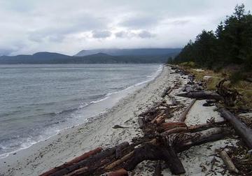
Vancouver continued on to Birch Bay, then moved his ships out into Georgia Strait to rendezvous with the Spanish. The Spanish vessels were schooners, only fourteen metres long with crews of about twenty men, much smaller than their British counterparts. The small flotilla worked its way northward along the stretch of shoreline that tourist promoters would later give the cheerful name, Sunshine Coast. Vancouver found it anything but cheery. The low skies, unbroken forest and brooding mountain ranges left him depressed; he used words such as gloomy, dull, dismal, uninteresting and dreary to describe what he saw and the way he felt.
(It is tempting to deride Vancouver for being too blinkered by his European aesthetic to recognize the wild beauty of the coast. Europeans preferred nature to be picturesque, cultivated, not so apparently inimical to human settlement. But it should also be recalled that Vancouver was conducting his survey during a period of global cooling now known as the Little Ice Age. From roughly 1300 to 1850 the climate was generally cooler than it later became; during the eighteenth century, for instance, mountain glaciers are known to have been in advance all over the world. When the first Europeans arrived on the Northwest Coast they experienced a world that was quite different from the present: colder, cloudier, wetter, in general much less pleasant.)
As the Europeans passed up the coast they anointed the landscape with names: names of friends, of naval colleagues, of national heroes and famous battles. Naming was a way of claiming. It was also a way to honour patrons, to recall past glories, to curry favour with superiors; a way, in short, of making the coast British while at the same time advancing a career. The Spanish did their own christening in their own language, but for the most part it is the British names that have survived. Cape Mudge, after Lieutenant Zachary Mudge, one of Vancouver’s officers. Bute Inlet, after the Earl of Bute, a prominent politician. Burrard Inlet, after Harry Burrard, a friend and former shipmate. And on, and on.
After investigating Desolation Sound (named by Vancouver for what he found to be its gloomy atmosphere) and probing the channels and inlets at the north end of Georgia Strait, the two expeditions went their separate ways. It became obvious to Vancouver from the tidal flow that open water existed ahead of him; that is, that Vancouver Island was just that, an island; and he decided to follow what appeared to be the most navigable passage northward via Discovery Passage and Johnstone Strait, what is today the main shipping channel through the lower Inside Passage.
The Spanish preferred to investigate the labyrinthine back channels through the islands that lie between the mainland and the large island. Like the British, they concluded that this stretch of coastline had little to recommend it. The author of the official journal of the Spanish expedition concluded that “the gloomy and sterile districts in the interior of this strait offered no attraction to the trader, since in them there were no products, either of sea or land, for the examination or acquisition of which it was worth while to risk the consequences of a lengthy navigation through narrow channels, full of shoals and shallows. We did not see otters or other animals whose skins might set an edge on greed; the character of the land did not offer expectations that places would be found suitable for the formation of settlements or in which the winter could, in case of need, be passed. Only a philosopher might, perhaps, find in these districts food for reflection, seeing there a land and peoples so near to the primitive state of the world, so far removed from European civilization, which they did not appreciate and for which they had no desire.”
The explorers had entered the territory of the Kwakwaka’wakw, who inhabit northern Vancouver Island, the adjacent mainland and the scattering of islands in between. As the Spanish journalist noted, much of this territory was barren of sea otter, so contact with outsiders had to this point been limited. But the Kwakwaka’wakw of Johnstone Strait were not so completely cut off from “civilization”. They were already receiving a steady flow of European goods, obtained via traditional trading routes from the Nuu-chah-nulth on the other side of Vancouver Island. When Captain Vancouver stopped at the village of Whulk at the mouth of the Nimpkish River, he reported that the people were growing bored with iron goods and “nothing but large sheets of copper and blue woollen cloth engaged their attention in a commercial way.” Not exactly the naive primitives that the Spanish described.
It was early August and Vancouver decided he had time to carry out one more survey before heading for Nootka. After surviving a near disaster when both Discovery and Chatham grounded on reefs in Queen Charlotte Strait, he sailed across Queen Charlotte Sound, one of the few places along the coast where the mainland is exposed to the open Pacific, before ducking into the long reach of FitzHugh Sound and finding a harbour at Safety Cove, a nick on the inside shoreline of Calvert Island. From there the final boat expeditions of the summer were launched to explore Smith Sound, Rivers Inlet and Burke Channel. When these were completed, Vancouver weighed anchor for Nootka, where he arrived at the end of the month to find his Spanish counterpart, Juan Francisco de la Bodega y Quadra, waiting for him.
Next time: Diplomacy at Nootka
Browse by label
- ABORIGINAL AFFAIRS (1 Post)
- ABORIGINAL HISTORY (1 Post)
- ADBUSTERS (1 Post)
- ALICE MUNRO (1 Post)
- ASAHI (1 Post)
- BC (1 Post)
- BC FERRIES (1 Post)
- BC HISTORY (1 Post)
- BC WRITERS (1 Post)
- BALLET (1 Post)
- BARKERVILLE (1 Post)
- BEEVOR-POTTS (1 Post)
- BLACK (1 Post)
- BOOKS (1 Post)
- BRITISH EMPIRE GAMES (1 Post)
- COVID-19 (1 Post)
- CAMPBELL RIVER (1 Post)
- CANUCKS (1 Post)
- CHINATOWN (2 Posts)
- CHINESE (1 Post)
- CHINESE CANADIANS (1 Post)
- CLAYBURN (1 Post)
- COLUMBIA RIVER TREATY (1 Post)
- COMMUNIST (1 Post)
- DALY (1 Post)
- DEPRESSION (1 Post)
- DOUKHOBORS (1 Post)
- EXPO (1 Post)
- FATHER'S DAY (1 Post)
- FIRST NATIONS (1 Post)
- FIRST NATIONS (1 Post)
- FORESTRY (1 Post)
- FRASER VALLEY (1 Post)
- GASTOWN (1 Post)
- GIBSONS (1 Post)
- GREAT BEAR RAINFOREST (1 Post)
- HAIG BROWN HOUSE (1 Post)
- IGLAUER (1 Post)
- INDIGENOUS PEOPLES (1 Post)
- INSIDE PASSAGE (1 Post)
- ISTOMINA (1 Post)
- JAMES DOUGLAS (1 Post)
- JAMES SINCLAIR (1 Post)
- JEWISH HISTORY (1 Post)
- JOE FORTES (1 Post)
- JUSTIN TRUDEAU (1 Post)
- K&C THERMOGLASS (1 Post)
- KITSAULT (1 Post)
- KNIGHT (1 Post)
- KNOWBC (1 Post)
- LABOUR (1 Post)
- LOUIS TAYLOR (1 Post)
- MUCHALAHT (1 Post)
- NANAIMO (1 Post)
- NELSON ISLAND (1 Post)
- NEW STAR BOOKS (1 Post)
- NOOTKA SOUND (1 Post)
- NORTH VANCOUVER (1 Post)
- NORTH VANCOUVER MUSEUM (1 Post)
- PAULINE JOHNSON (1 Post)
- PENDER HARBOUR (1 Post)
- PHOTOGRAPHY (1 Post)
- POLITICS (1 Post)
- REMEMBRANCE DAY (1 Post)
- RIVERS INLET (1 Post)
- RIVERVIEW (1 Post)
- ROCKY MOUNTAINS (1 Post)
- SALT SPRING (1 Post)
- SAVARY ISLAND (2 Posts)
- SEATTLE (1 Post)
- STANLEY PARK (1 Post)
- SUNSHINE COAST (2 Posts)
- SURREY (1 Post)
- THOMAS (1 Post)
- VANCOUVER (12 Posts)
- VANCOUVER HISTORY (1 Post)
- VANCOUVER ISLAND (1 Post)
- VANCOUVER HISTORY (5 Posts)
- VANCOUVER125 (6 Posts)
- VICTORIA (3 Posts)
- WORLD WAR ONE (1 Post)
- WORLD WAR TWO (1 Post)
- YUQUOT (1 Post)
- ALICE ARM (1 Post)
- ARCHAEOLOGY (1 Post)
- ART (1 Post)
- ARTS (36 Posts)
- ASIANS IN BC (5 Posts)
- AVIATION (4 Posts)
- AWARDS (1 Post)
- BATHTUB RACE (1 Post)
- BC (1 Post)
- BEARS (1 Post)
- BOAT BUILDING (2 Posts)
- BOATBUILDING (3 Posts)
- BOATS (5 Posts)
- BOOK PRIZES (1 Post)
- BOOK PUBLISHING (1 Post)
- BOOKS (64 Posts)
- BOOKSTORES (1 Post)
- BOSTON BAR (1 Post)
- BUSINESS (10 Posts)
- BUTE INLET (1 Post)
- CHILD MIGRATION (1 Post)
- CHINATOWN (2 Posts)
- CHRISTMAS (2 Posts)
- CHUCK DAVIS (1 Post)
- CLIMATE (1 Post)
- COAST HISTORY (46 Posts)
- COAST SCENERY (1 Post)
- COASTAL HISTORY (1 Post)
- COMIC BOOKS (1 Post)
- CRIME (3 Posts)
- DISASTERS (2 Posts)
- DIVORCE (1 Post)
- EARTHQUAKES (1 Post)
- EDUCATION (10 Posts)
- ELECTIONS (1 Post)
- ENEMY ALIENS (1 Post)
- ENERGY (1 Post)
- ENTERTAINMENT (17 Posts)
- ENVIRONMENT (19 Posts)
- FILM (1 Post)
- FIRST NATIONS (24 Posts)
- FISHERY (1 Post)
- FISHING (2 Posts)
- FORESTRY (2 Posts)
- GOLD RUSH (2 Posts)
- HISTORIC SITES (2 Posts)
- HISTORY (135 Posts)
- HOCKEY (5 Posts)
- HOLIDAYS (4 Posts)
- HOMELESS (1 Post)
- HOSPITALS (1 Post)
- HOTELS (1 Post)
- HOURSTON GLASCRAFT (1 Post)
- HOUSING (1 Post)
- HUMOUR (1 Post)
- INDUSTRY (1 Post)
- INTERNET (1 Post)
- INTERNMENT (1 Post)
- JAZZ (1 Post)
- JOURNALISM (10 Posts)
- KANAKAS (1 Post)
- KILLER WHALES (1 Post)
- LABOUR (10 Posts)
- LANDMARKS (37 Posts)
- LEASK BROTHERS (1 Post)
- LIBRAIRIES (1 Post)
- LIBRARIES (1 Post)
- LITERATURE (18 Posts)
- MAGAZINES (1 Post)
- MARINE LIFE (1 Post)
- MEDIA (15 Posts)
- MEDICINE (4 Posts)
- MEMOIR (8 Posts)
- MENTAL HEALTH (1 Post)
- MINING (1 Post)
- MISSING WOMEN (1 Post)
- MONUMENTS (12 Posts)
- MOUNTAINEERING (1 Post)
- MUSEUM (1 Post)
- MUSEUMS (21 Posts)
- MUSIC (5 Posts)
- MYSTICS (2 Posts)
- NATURAL HISTORY (1 Post)
- NIGHTCLUBS (1 Post)
- NORTH VANCOUVER (1 Post)
- OCCUPY (1 Post)
- OKANAGAN (1 Post)
- OLYMPICS (1 Post)
- ORCAS (2 Posts)
- PANDEMIC (1 Post)
- PARKS (2 Posts)
- PEOPLE (73 Posts)
- PERIODICALS (1 Post)
- PHOTOGRAPHS (15 Posts)
- PHOTOGRAPHY (7 Posts)
- PHYSICAL GEOGRAPHY (1 Post)
- PIPELINES (1 Post)
- PLACES (45 Posts)
- POETRY (2 Posts)
- POLICE (1 Post)
- POLITICAL PROTEST (2 Posts)
- POLITICS (54 Posts)
- PORT ALBERNI (1 Post)
- PORTUGUESE MIGRATION (1 Post)
- POSTAGE STAMPS (1 Post)
- PREHISTORY (2 Posts)
- PROHIBITION (1 Post)
- PROSTITUTION (3 Posts)
- PROTEST (1 Post)
- PUBLIC HEALTH (3 Posts)
- PUBLIC STATUES (3 Posts)
- PUBLISHING (3 Posts)
- RAILWAYS (2 Posts)
- REFERENDA (1 Post)
- RELIGION (5 Posts)
- ROAD-TRIPS (4 Posts)
- ROYAL VISITS (2 Posts)
- SCIENCE (11 Posts)
- SELF PROMOTION (1 Post)
- SELF-PROMOTION (11 Posts)
- SHIPWRECKS (1 Post)
- SILVEY FAMILY (1 Post)
- SKEENA (1 Post)
- SKUNKS (1 Post)
- SPORT (1 Post)
- SPORTS (19 Posts)
- SUBMERSIBLES (1 Post)
- TECHNOLOGY (1 Post)
- TENANTS (1 Post)
- TERRORISM (1 Post)
- TOURISM (13 Posts)
- TRANS-CANADA HIGHWAY (1 Post)
- TRANSIT (1 Post)
- TRANSPORTATION (34 Posts)
- TRAVEL (1 Post)
- TREATIES (1 Post)
- TREEPLANTING (1 Post)
- TSUNAMIS (1 Post)
- URBAN LIFE (1 Post)
- URBAN SCENE (29 Posts)
- VANCOUVER (4 Posts)
- VANCOUVER 125 (6 Posts)
- VANCOUVER ISLAND (1 Post)
- WAR (7 Posts)
- WEBSITES (1 Post)
- WHALES (3 Posts)
- WHALING (1 Post)
- WILDFIRE (1 Post)
- WILDLIFE (15 Posts)
- WORLD WAR 1 (1 Post)
